When C.D. Stelzer called the Department of Energy’s FUSRAP office back in 1997, a secretary for a private company answered the phone, two corporate managers acted as mouthpieces for the government, and the DOE official in charge had gone elk hunting.
first published in the Riverfront Times, Dec. 3, 1997
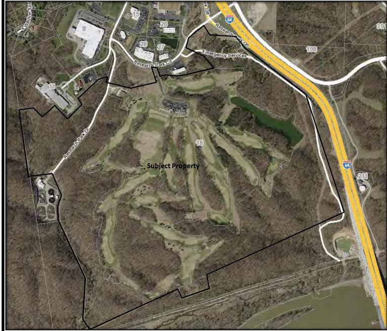
IT’s shift change on Friday afternoon at the Boeing plant north of Lambert Field and workers are fleeing in droves, streaming bumper-to-bumper down McDonnell Boulevard, oblivious to the narrow, 21.7-acre piece of real estate next to the thoroughfare. Until recently, this barren stretch of earth offered little to see besides an abundance of weeds surrounded by a rusty cyclone fence topped with barbed wire. In late September, however, the U.S. Department of Energy (DOE) began rearranging the landscape on the property. From the shoulder of the road, where it crosses Coldwater Creek, a yellow bulldozer and backhoe can now be seen parked near a plywood wall extending across the top of the steep embankment leading down to the creek bed.
It’s hard to tell, at a glance, that the work in progress here is part of an overall federal project estimated to cost nearly $800 million. Ordinary building materials — bales of straw, rocks and plastic sheeting — create a setting common to construction sites. But this is no ordinary erosion-control action. Soil at this location, known in regulatory circles as SLAPS (St. Louis airport site), harbors deadly byproducts of the nuclear-weapons industry, which developed during World War II and mushroomed in the Cold War. From 1946 until the mid-1960s, the U.S. Army — and, later, the Atomic Energy Commission (AEC) — dumped hundreds of thousands of cubic yards of radioactive waste,  residue from uranium processing at the Mallinckrodt Chemical Works in St. Louis.
As a consequence, the acreage, which is now owned by the St. Louis Airport Authority, has been contaminated with increased levels of uranium-238, radium-226 and thorium-230, according to the DOE. This is no new discovery, of course. Official foot-dragging has been going on for decades. More than 20 years ago the DOE discovered that contaminants had migrated into ditches next to McDonnell Boulevard, where they have settled only inches from the surface. There are still no signs to warn passersby or curious onlookers of this danger.
Failure to inform the public and act in a timely manner has been the hallmark of this case. At the same time, public-health officials have consistently downplayed or ignored the potential health consequences of radiation exposure. After allowing the waste to spread for more than 50 years, the federal government is now belatedly rushing to deal with the problem in a fashion comparable to its past negligence. In the process, rules have been sidestepped and decisions made without a full understanding of their implications. The powers-that-be first attempted to keep the problem a secret, after World War II, for “national-security reasons.” By the late 1970s, however, the festering pollution had become a heated public issue.
The waste itself has proven even more difficult to contain than the controversy over it.
COLDWATER CREEK, which is next to the site, flows through a large section of North St. Louis County and has acted as a convenient vehicle to transport the toxic materials. So far, radioactive contaminants are known to have hitched a ride downstream more than seven miles, according to the DOE. And the migration is continuing. Tests conducted in late 1994 show stormwater runoff at the location still exceeding acceptable radiation levels set by the agency. Drinking-water intakes for the city of St. Louis are located several miles downstream from the site, on the Mississippi River at Chain of Rocks. The radioactive migration by way of groundwater has also been confirmed but is less well understood.
For years, the DOE claimed the waste presented no danger. But the scientific community, which has been moving much more slowly than the waste, has finally concluded that no safe level of radiation exposure exists. By the time this decision was made several years ago, it was also widely accepted that one direct effect of long-term exposure to low-level radiation is cancer.
The $8.3 million cleanup along Coldwater Creek is the first stage of the long-anticipated project. The initial phase involves removing at least 6,000 cubic yards of the contaminated soil to a licensed repository for low-level radioactive waste, located in Utah. The amount is only a small fraction of the contaminated materials that may ultimately be excavated and shipped from the site. The approximate completion date: 2004.
But the entire project now stands in bureaucratic limbo. Less than a month after the DOE started working at the airport site, Congress transferred authority for the cleanup to the U.S. Army Corps of Engineers. The change came about as a part of the latest Energy and Water Appropriations Bill, signed into law by the president in October. Under the legislation, the corps will be handed the remainder of the $5 million already allocated to the DOE for this fiscal year to shore up the small section of Coldwater Creek. The money is in addition to the $140 million appropriation for 1998 that continues funding a nationwide cleanup of low-level radioactive-waste sites. The act also stipulates that the corps must conduct a three-month assessment of the Formerly Utilized Sites Remediation Action Program (FUSRAP), the federal aegis under which the airport site falls.
For the time being, the cleanup of Coldwater Creek is expected to continue uninterrupted, according to David Leake, project manager for the corps. “Congress has made it fairly clear that they do not want the transfer to result in any delay,” says Leake. This pragmatic strategy, however, locks the corps into adopting some of the DOE’s prior policies and practices, many of which have fallen into question in the past.
R. Roger Pryor, executive director of the Missouri Coalition for the Environment, says the corps isn’t carrying the same baggage as the DOE. “I feel the corps doesn’t have the past bias that nuclear waste is somehow good for you,” says Pryor. “However, changing horses in midstream is difficult.”
Even though the airport site is on the U.S. Environmental Protection Agency’s (EPA) National Priorities List (NPL), the DOE, through a regulatory loophole, was allowed to proceed with the Coldwater Creek excavation without formulating any long-range cleanup plan for the entire site. Furthermore, the DOE’s interim plan admits the area now being dug up may have to undergo remediation again sometime in the future. In other words, the current work is at best a stopgap measure. The project may also leave some radioactive contaminants behind because the excavation doesn’t go deep enough. In addition, the DOE started working on the site before a hydrogeological study, which it commissioned, had been completed. A previous hydrogeological study, published last year, cautioned that the groundwater system underneath the site was not clearly understood. The panel of experts concurred that implementation of any excavation work would necessitate further site characterization.
Specifically, the panel, which comprised government and industry scientists, warned of the existence of large volumes of radioactive contamination in the middle of the 21.7-acre site. The location of those contaminants is uphill from the current excavation work. It doesn’t take a nuclear physicist to figure out
that water rolls downhill. By beginning the cleanup at the low end of the site, the DOE hoped to create a buffer that would stop or at least slow the migration of the radioactive pollutants into the creek. But by starting at this point, the department admittedly risks re-contaminating the area it has chosen to clean up. Sheet erosion from rainfall will continue to allow contaminants to move toward the creek. Groundwater will head in the same general direction. Indeed, the subterranean currents may circumvent the DOE’s efforts altogether because, according to the experts, the hydrogeological structure beneath the site pushes groundwater both north and west under McDonnell Boulevard.
“I’m delighted that they are beginning to clean up the airport site,” says Kay Drey, an environmental activist from University City. “But they’re not doing it safely.” Drey, who fought for the cleanup for years, resigned from the project’s oversight committee on Sept. 18 (see accompanying story). In her resignation letter to St. Louis County Executive George “Buzz” Westfall, she expressed disapproval of the DOE’s interim plan, citing what she considers to be inadequate precautions. Before her resignation, she had submitted a detailed eight-page critique of the DOE’s plan. To date, she has received no answers to her questions.
FROM THE MCDONNELL Boulevard bridge, the turbid waters of Coldwater Creek are visible, flowing past chunks of concrete debris and swirling around a white plastic lawn chair marooned midstream. It is a typical suburban scene, a once-pristine waterway relegated to carrying sewage. Coldwater Creek carries other pollutants, too: Jet fuel from nearby Lambert Field has found its way into the watershed, as have salt, oil and automotive antifreeze, according to a DOE assessment. Another pollutant in the surface water is trichloroethylene, a known carcinogen. No one is certain of the long-term effects of such mixed waste on the environment or human health. It is also unknown how the chemical stew affects the migration of radioactive contaminants in surface and groundwater.
In essence, the airport site is a very large experiment with few scientific controls attached.
On the basis of data provided to it by cleanup-site contractors, last year’s hydrogeological panel decided contamination levels at the site would not pose an imminent risk for the next 100 years, an arbitrary figure imposed by the DOE’s guidelines. Yet some radioactive isotopes already discovered in ground and surface water at the site will last for hundreds of thousands of years. Although it downplayed the risks over the next century, the panel nevertheless concluded it would be inappropriate to use the site for long-term storage and repeatedly stated that many questions about the hydrology of the area remain a mystery.
Seepage of radioactivity into groundwater is by no means unique to St. Louis. Last week, the DOE formally admitted that the aquifer underlying the 560-square-mile Hanford nuclear reservation in Washington state has been contaminated. The radioactive waste, which is moving toward the Columbia River, is the result of 40 years of plutonium production at the site. The DOE, which long denied that groundwater contamination existed at Hanford, now claims the Columbia will not be threatened for the proverbial 100 years. However, the independent scientific analysis that forced the DOE to confess to the groundwater contamination calls the DOE’s estimates on risks to the river “unreliable.”
Tom Aley, a hydrologist who sat on the panel that studied the St. Louis airport site, is sure of one thing: The waste should have never been dumped here in the first place. Similar to Hanford, the waste here is situated on top of an aquifer. “It is a very poor site for disposal of that type,” says Aley, who owns Ozark Underground Laboratory Inc. Aley lists population density, groundwater contamination and the proximity of the site to Coldwater Creek as reasons not to store radioactive waste at the airport site.
His tempered approval of the cleanup is based in part on the lack of groundwater use in the area. However, Aley concedes there is much yet to be learned. “We don’t really have a good understanding of the vertical contamination,” he says. “The waste was deposited in a very haphazard manner, which was typical of that era. That has made cleanup very difficult. Another thing is, you can never totally clean up a site. A lot of these cleanups are real bootstrap operations. You have to pull one boot up, and then you have to pull the other up.”
The emperor may have buckled his boots, but he is without clothes. In short, no plan exists as to how to proceed with the remainder of the cleanup. Indeed, according to details of the DOE’s interim action, the current $8.3 million creek cleanup may ultimately have to be redone. The DOE’s engineering evaluation/cost analysis clearly states: “Although final clean-up criteria have not been established for this site, it is anticipated that the majority of the area cleaned up by this action will not require additional effort. However, final clean-up criteria, once selected, could require additional efforts in areas excavated in this removal action.”
Although the DOE acknowledges contamination at the site extends at least 18 feet deep, its interim plan requires digging only “eight to 10 feet below the existing land surface,” according to a Federal Register notice published in September. The DOE also acknowledges that “soil contaminated with radionuclides is present below (the) water table.” If contaminated groundwater is encountered during the dig, the DOE’s interim plan calls for it to be pumped onto high ground, which means it will re-enter the aquifer or run back downhill, toward the creek.
To battle this inevitable gravitational pull, the DOE has built a berm to separate the excavation work from the rest of the site. The interim action also calls for a channel to be constructed to reroute stormwater away from the roadside ditch that drains into the creek. In 1985, the DOE constructed a gabion wall — rocks secured by a wire basket — to hold the bank from sliding into the creek. It is a porous structure that by design allows water to percolate through. Whereas the effectiveness of these measures is subject to debate, there is no argument that radioactive sediments can still move downward into the aquifer and flow northwest under McDonnell Boulevard, thereby entering the creek unimpeded.
The hydrogeological study from last year warned about this possibility. “Groundwater monitoring has shown the migration of radionuclides in the direction of groundwater flow across McDonnell Boulevard and under the formerly used ball fields property to the north,” according to the study. “This factor raises concern over potential shallow discharge of radionuclides to Coldwater Creek to the west and north and potential vertical migration to the lower aquifer system.”
Three thousand people live within a one-mile radius of the airport site, according to DOE estimates. From the airport, Coldwater Creek flows northeast for 15 miles, touching the communities of Berkeley, Hazelwood, Florissant and Black Jack before discharging into the Missouri River. The city of St. Louis drinking-water intakes at Chain of Rocks, which supply water to hundreds of thousands of people, are five miles downstream from where the Missouri joins the Mississippi.
By any standard it is a densely populated watershed. DOE guidelines for thorium and radium concentrations mandate they not exceed 5 picocuries per gram averaged over the first 15 centimeters of soil and 15 picocuries per gram in subsequent soil layers of the same thickness. Analysis conducted for DOE in 1985 indicates that soil next to Coldwater Creek is contaminated with as much as 14,000 picocuries of thorium-230 per gram. The naturally occurring background level for the same radioactive isotope amounts to 0.2 picocuries per gram.
The corresponding guideline for acceptable DOE levels of uranium-238, which is also found at the airport site, is 50 picocuries per gram. In 1981, DOE initiated a two-year groundwater-monitoring program at the site and discovered uranium-238 at concentrations up to 2,230 picocuries per gram. Other evidence shows radioactive waste is spread across the site at levels thousands of times greater than considered acceptable.
A curie is the amount of radiation emitted from one gram of radium, equal to 37 billion decays per second. A picocurie equals a trillionth of a curie. Curies are used to measure the amount of material present; they don’t indicate the amount of radiation given off or its biological hazards.
Such DOE standards ignore potential health consequences, according to a 1991 congressional study. “The present regulatory-driven approach … places far more emphasis on characterizing the contamination than on investigating health impacts and may prove ill-suited to identifying public health concerns, evaluating contamination scenarios according to their potential for adverse health effects, or establishing health-based clean-up priorities,” the Office of Technology Assessment report states.
JOHN W. GOFMAN, a professor emeritus of medical physics at the University of California at Berkeley, has long contended that there is no safe level of radiation exposure. “I concluded it’s impossible for such a level to exist given the evidence on how radiation works,” says Gofman. The term “low-level radiation” is a political term used by the nuclear industry to lull the public into accepting exposure risks, he says. Similar phrases also downplay the consequences. “The terms `tolerance level,’ `allowable level,’ `permissible dose’ — those are all phenomenal words that are supposed to tell Joe Six-Pack, `Nothing to worry about — there ain’t no harm.’ That’s why these terms came into existence,” he asserts.
The 79-year-old Gofman is in a unique position to advise on such matters because he is a physician and holds a doctorate in nuclear physical chemistry. His research at Berkeley during World War II attracted the attention of J. Robert Oppenheimer, lead scientist in the Manhattan Project. After working on the atomic bomb at Oppenheimer’s request, Gofman completed his medical studies. But in 1969, Gofman fell from grace with the atomic establishment when he challenged the “acceptable” levels of radiation exposure then allowed.
After being ostracized by the atomic establishment for years, Gofman’s scientific opinions have been widely accepted of late. In 1990, for instance, after years of debate by U.S. scientists, a report by the fifth conference on the Biological Effects of Ionizing Radiation (BEIR V) concluded that radiation effects are proportional to dose in all cases. More recently, says Gofman, “The United Nations Scientific Committee on the Effects of Atomic Radiation said that the weight of evidence comes down on the side of no safe level. And the British National Radiological Protection Board in 1995 published a document in which they have now said that there can be no safe dose.”
Studies such as these lead Drey, the environmentalist, to question the logic of allowing further radioactive contamination to flow into Coldwater Creek. “Dilution is not the solution to pollution in reality or legally,” says Drey. “When you are dealing with materials that will continue to give off radioactive particles forever into the future, literally billions of years, you have to be very careful with this stuff.”
THIS IS NOT THE FIRST TIME Drey has opposed a DOE project. In 1993, she battled the department’s plans to clean up radioactive waste at nearby Weldon Spring in St. Charles County (“Rushing Water,” RFT,Jan. 6, 1993). Her vigilance then temporarily delayed that project, after she exposed the fact that the DOE was going ahead before receiving critical EPA test results.
Stephen H. McCracken, who headed the Weldon Spring cleanup, took over as St. Louis airport-site manager for the DOE earlier this year. Although the circumstances and nature of the radioactive waste may be different at the airport site, McCracken’s job switch hasn’t seemed to have affected his ability to circumvent government guidelines. If anything, the DOE official’s evasive end-runs appear to have improved over time.
Pryor, of the Coalition for the Environment, recalls that the decision was railroaded past the citizens oversight committee on which he sits. “We had hardly seen this darn thing,” says Pryor of the recommendation to proceed with work along the creek. “When we asked McCracken in September, he admitted it was just a guess,” says Pryor, referring to the point at which the DOE decided to begin excavating. The measure squeaked past the committee on a 4-3 vote. “We thought it was silly to go forward without the geological study,” says Pryor.
On Sept. 18, the day Drey resigned, McCracken signed a memorandum, which was immediately filed away. The memo cites an emergency clause that allowed him to waive the DOE’s standard 15-day public-review period for such actions. Sept. 18 also just happened to be the day DOE issued its “Flood-plain Statement of Findings” in the Federal Register. The purpose of the posting was to notify individuals and other government agencies of the pending action at the airport site so they could scrutinize the plan in advance. The notice clearly states: “DOE will endeavor to allow 15 days of public review after publication of the statement of findings before implementation of the proposed action.”
Four days later, on Sept. 22, work began at the St. Louis airport site.
Every conceivable government agency — local, state and federal — was left out of the loop. Even the DOE official who has oversight into such matters said he was unaware the emergency clause had been invoked. “I suppose you’d have to ask Steve McCracken about that,” drawled James L. Elmore, a National Environmental Policy Act (NEPA) compliance officer for the DOE in Oak Ridge, Tenn. “I don’t have anything to do with that. You’d really have to ask him exactly what his total thought process was.” Despite his ignorance, Elmore’s name appears on the bottom line of the Sept. 18 Federal Register notice.
The RFT could not initially reach McCracken to explore his “thought process,” because, according to the secretary at the DOE site office, he was elk hunting in Colorado. After returning from his expedition, the DOE manager still did not return repeated calls placed to his office for a week. In his Sept. 18 waiver memo, however, McCracken wrote he had expedited the cleanup out of concern that autumn rainfall would make excavating near the creek more difficult. Come hell or high water, McCracken is expected to continue working at the site, at least during the transition period.
The airport site is on the Superfund’s NPL list, according to Dan Wall at the EPA regional headquarters in Kansas City. Because of its priority status, the agency is obliged to oversee the cleanup, he says. But it appears the contractors are more in control of the project than anybody else.
Calls placed to the DOE’s site office in St. Louis are answered by the cheerful voice of Edna, a secretary who works for Bechtel National Inc., one of the DOE’s prime cleanup contractors. She takes messages for McCracken and his assistant. In this case, she took messages for nearly two weeks, and for nearly two weeks the calls went unreturned. Finally, representatives for the DOE’s two prime contractors called back.
A secretary for a private company answers the phone at a government office, two corporate managers act as the mouthpieces for a government project, and the government official who is supposed to be in charge is elk hunting. This gives the appearance that the tail is wagging the dog. That may soon change under the new leadership of the corps. “The corps and the DOE operate somewhat differently,” says Leake. “The DOE will put very few people on a particular program and rely heavily on large national contractors to do a lot of the things that the Corps of Engineers try to do internally.”
The change in management styles will affect all of FUSRAP, which originated in 1974 under the AEC, the predecessor of the DOE. AEC established FUSRAP to deal with radioactive waste produced as a byproduct of nuclear-weapons production. Of the 46 FUSRAP sites across the country, 25 have been cleaned up, according to the DOE. Four remaining radioactive hotbeds are in the St. Louis area, with the airport site the largest.
In St. Louis and elsewhere, the DOE has relied on the expertise of Bechtel and Science Applications International Corp. to carry out its mission.
Wayne Johnson, the deputy project manager for Bechtel in St. Louis, is certain the cleanup next to Coldwater Creek is being carried out safely. “These measures have been monitored by the Missouri Department of Natural Resources, which has had representatives on the site routinely to look at our operations to make sure that we are not affecting the creek. In addition to that, St. Louis County, which has advised us on our plans for the work, has been out to the site,” says Johnson. “So we feel confident, and we are more than halfway done. We have not had any problems or affected the creek in any way.”
Ric Cavanagh of the St. Louis County Health Department, who chairs the citizens oversight commission, agrees with Johnson’s assessment. “I’m not a lawyer, but it is my understanding that they (the DOE) did make use of a provision in the rules to move forward. The majority of the oversight committee voted in favor of proceeding with the work,” says Cavanaugh. “We are purely advisory. We couldn’t have stopped it if we wanted to. The groundwater levels were very low at the time, and this was a very good time to get things going. (St. Louis County’s) goal was to get excavation begun and to get work begun at that site. So we were pleased to have it go from that standpoint.”
The oversight committee currently has 11 members — five from the city of St. Louis and six from St. Louis County. One seat remains vacant at this time. The board replaces an advisory task force that disbanded last year.
AT ONE TIME, workers toiled night and day to dump the radioactive waste at the airport site. The open pile rose to 20 feet above ground level, according to one DOE document. Altogether the accumulated waste at the site and elsewhere nearby is estimated to have once ranged from 283,700 to 474,000 cubic yards, according to the DOE. In additional to open dumping, Mallinckrodt workers were required to hand-pack waste in 30- or 55-gallon drums. The drums were then stacked on top of each other at the airport site. The barrels then began to leak.
In the process of storing the waste, haul routes and adjacent properties became contaminated. Then in 1966, the AEC sold most of the residues to Continental Mining and Milling Co, which promptly transported the waste to 9200 Latty Ave. in Hazelwood and then went bankrupt. The movement resulted in the contamination of more properties. Cotter Corp., a subsidiary of Commonwealth Edison, subsequently acquired the materials, with an eye toward reclaiming some of the minerals. The bulk of it ended up in Canon City, Colo., but not before one of Cotter’s subcontractors dumped thousands of tons of the waste in the West Lake landfill off Old St. Charles Rock Road in North St. Louis County.
More than 50 years after it started, the uranium-processing operation conducted at Mallinckrodt in St. Louis has forced almost $800 million in reparations on U.S. taxpayers — the cost of cleaning up the radioactive vestiges of World War II and the arms race that followed. To the victors go the spoils. It is a small part of the environmental damage wrought by the federal government and the nuclear-weapons industry over the last half-century — damage estimated to cost $200 billion to correct. What can never be measured are the lives cut short because of radiation exposure. Men have been tried for war crimes that did far less.